
WASHINGTON, Aug. 1 (DC Times Online) — The National Hurricane Center was forecasting no tropical activity in the Atlantic basin, Caribbean Sea or Gulf of Mexico through the following week in its Aug. 1 outlook. For people in the United States, the practical step is to keep checking the center’s Tropical Weather Outlook during hurricane season, even when the basin is quiet.
The lack of activity reflects a mix of weather conditions, led by a strengthening El Niño. The climate pattern is producing stronger winds high above the Atlantic, which can tear apart developing thunderstorms. That effect is known as wind shear.
At the same time, Saharan dust and dry, stable air have been limiting thunderstorms over parts of the tropical Atlantic. Several tropical waves were moving west from Africa into the Atlantic’s Main Development Region, but the FOX Forecast Center said their chances of organizing would depend on whether they encountered enough wind shear, dust and warm water to overcome those obstacles.
Why El Niño matters
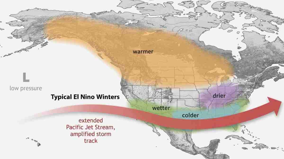
El Niño is a periodic warming of the central and eastern tropical Pacific Ocean. It can change the position and strength of the jet stream and other upper-level winds around the world. In the Atlantic, those changes often make it harder for tropical systems to form or strengthen.
NOAA’s Climate Prediction Center and other forecasters have said El Niño was strengthening faster than earlier expected. Forecast assessments cited by the FOX Forecast Center suggested the event could become one of the strongest since records began in 1950. That does not mean a record has been set, and it does not rule out Atlantic storms later in the season.
The Atlantic also has a competing influence: unusually warm water in the Main Development Region. Warm ocean water can provide energy for tropical storms, but warm water alone is not enough. A storm also needs thunderstorms that can organize and an atmosphere that allows them to remain together. Strong upper-level winds and dry air can prevent that process.
What the outlook says now
The National Hurricane Center’s seven-day outlook showed no areas of interest and essentially no chance of tropical development during the period covered by the outlook, according to the agency’s Thursday evening update reported in the supplied forecast summary. The center’s Aug. 1 report likewise expected no tropical activity in the Atlantic, Caribbean or Gulf during the following week.
That window is important. A quiet seven-day outlook describes the near-term environment; it is not a forecast for the entire hurricane season. Tropical conditions can change, especially as waves move west from Africa or as systems form closer to the United States, the Gulf of Mexico or the Caribbean.
The FOX Forecast Center reported that the season had produced two named storms by July 31. Earlier reports described only one storm during the first month, so the available accounts do not provide a fully reconciled storm count. Regardless of the count, forecasters have described the season’s start as slower than expected.
Seasonal forecasts still call for more activity before the season ends. NOAA’s forecast was reported as calling for 8 to 14 named storms, three to six hurricanes and one to three major hurricanes. Colorado State University’s forecast called for 11 named storms, five hurricanes and two major hurricanes. AccuWeather forecast 8 to 14 named storms, four to seven hurricanes and two to four major hurricanes.
A named storm has maximum sustained winds of at least 39 mph. It becomes a hurricane at 74 mph, and a major hurricane at 111 mph or higher. Seasonal forecasts are ranges, not promises about when storms will form or where they will go.
What people in the United States should do
There is no specific U.S. threat identified in the outlook described here. Residents along the Gulf Coast, Southeast coast and other Atlantic coastal areas should nevertheless use the quiet period to review hurricane plans, check emergency supplies and know how to receive alerts from local officials.
The National Hurricane Center is the certified source for official tropical-cyclone watches, warnings and outlooks. Its Tropical Weather Outlook provides the seven-day assessment of areas that could develop. If a system later threatens land, local emergency-management agencies will provide location-specific instructions.
Saharan dust, wind shear and El Niño may keep development limited in the near term, but none of those factors guarantees a quiet rest of the season. The next important question is whether the tropical waves moving off Africa can find a less hostile environment as they cross the Atlantic.
